
There are now five new gold mining companies that have active mining claims and/or have applied for mining permits in the Black Hills. In addition, there is the massive Wharf gold mine in the Northern Black Hills which is the only operating large-scale gold mining in the state of South Dakota. Each one of these companies may have multiple projects. We are working to keep you informed to help protect Black Hills land and water from this modern-day gold rush.
Update on Mining Activities in the Northern Black Hills that could impact Spearfish Canyon
June 1, 2026
Mining exploration for gold, lithium, and other minerals continues to move forward at an expedited pace in the Black Hills, most notably in the Northern Hills. Here are some of the major projects that are taking place currently:
1. Dakota Gold.
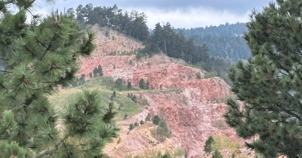
In 2025, the company reported to the State Department of Agriculture and Natural Resources (DANR) that they had drilled 200 exploratory holes out of their proposed 3400 holes that have DANR’s go-ahead. Their main project areas are the Richmond Hill area above Spearfish Canyon and the False Bottom Creek area near Maitland, which is east of the Canyon. The company is expected to apply for a large-scale mining permit to mine gold in the Richmond Hill area in the near future. DANR has confirmed that the southern end of Richmond Hill drains into Cleopatra Creek. The northern portion drains into Rubicon Gulch. Both flow downstream into Spearfish Creek. Rubicon Creek enters Spearfish Canyon at Bridal Veil Falls, a major tourist attraction.
2. Ponderosa Gold Exploration Project.
Solitario Resources Corporation has been granted a “categorical exclusion” by the US Forest Service, which is an administrative shortcut under the National Environmental Policy Act (NEPA). It allows the US Forest Service to approve certain projects without thorough environmental study, such as an Environmental Assessment (EA) or an Environmental Impact Statement (EIS). A categorical exclusion allows the company to drill from 49 drill pads, with the potential for multiple drill holes per pad. The project has just started and is located soth and west of Cheyenne Crossing. Primary access for the water trucks and other vehicles will be via Highway 85 and Long Draw Road. The project is expected to last 28 months over 4 years.
3. Golden Crest Gold Project.
This Solitario Resources gold exploratory project, approved by the Forest Service for up to 25 drill pads, is active. Drilling started in 2025 in an area favored by outdoor recreationists, especially mountain bikers. When the project started, the company placed a metal pipeline across a trail and up in the air, creating a very dangerous situation. Luckly, a biker saw it before anyone got hurt and reported it. The drill sites are located west of Spearfish Canyon and drain into the Canyon from the Big Hill area and to the south.
Find more information, project documents, and maps check out these links below:
- Agnico Eagle – Gilt Edge Superfund Site
- Dakota Gold & Dakota Territory Resource Corp.
- F3 Gold – Projects are the Jenny Gulch (POO) and the Newark (POO)
- Mammoth Minerals
- Solitario Resources Corp. Projects are Golden Crest (POO) and the Ponderosa (POO)
- Wharf Resources (USA) Gold Mine
