Black Hills Clean Water Alliance has identified and mapped thousands of active mining claims on federal lands in the Black Hills region. The results of this research highlight the vast extent of potential mining projects, as well as the modern gold rush that threatens Black Hills water, health, wildlife, and our recreation and tourism economy.
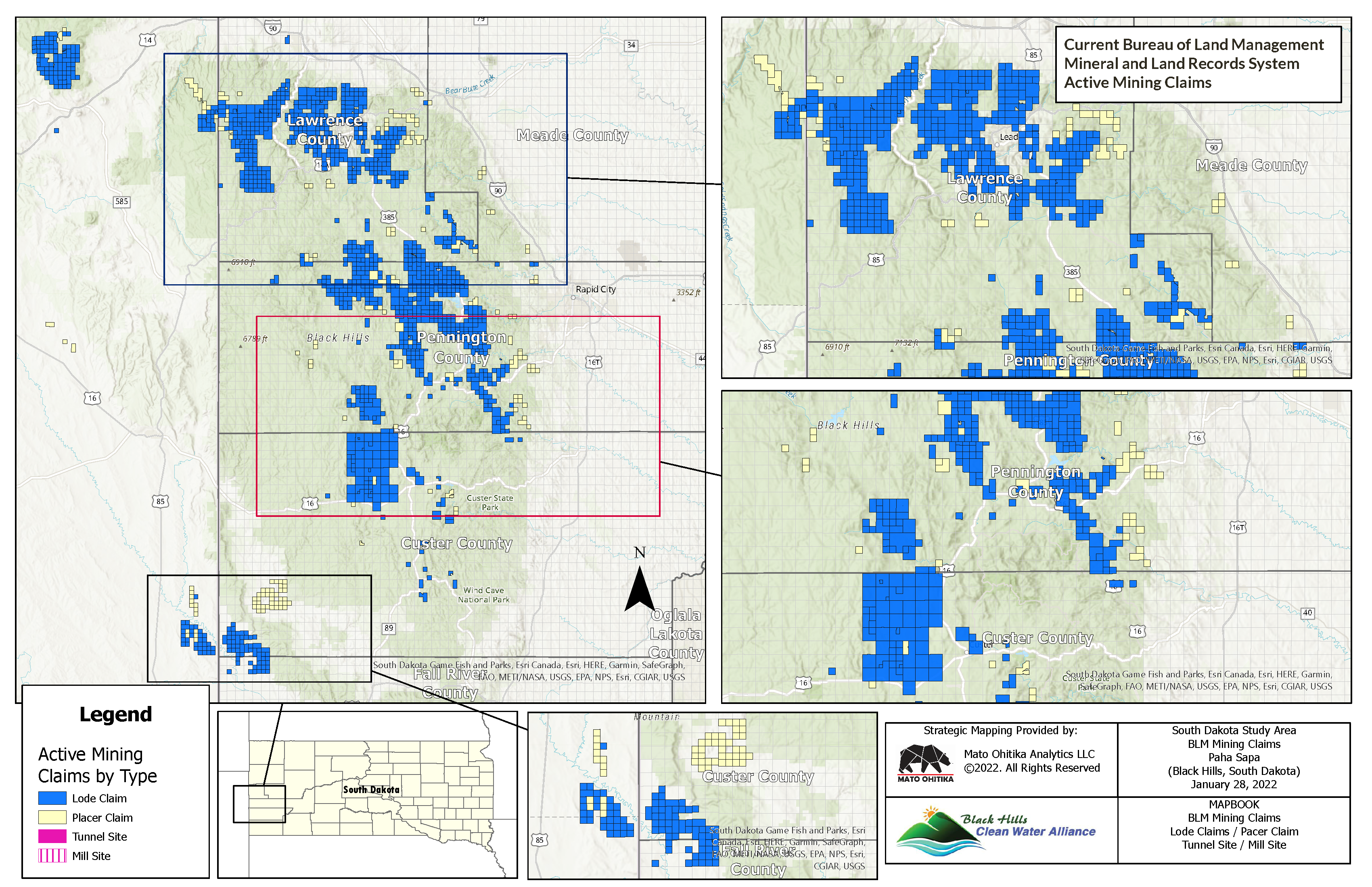
Two maps are included here. One, titled “Current Bureau of Land Management Mineral and Land Records System Active Mining Claims,” (all claims map) shows all active mining claims in the Black Hills as of January 2022, divided into four types: lode claim, placer claim, tunnel site, or mill site.
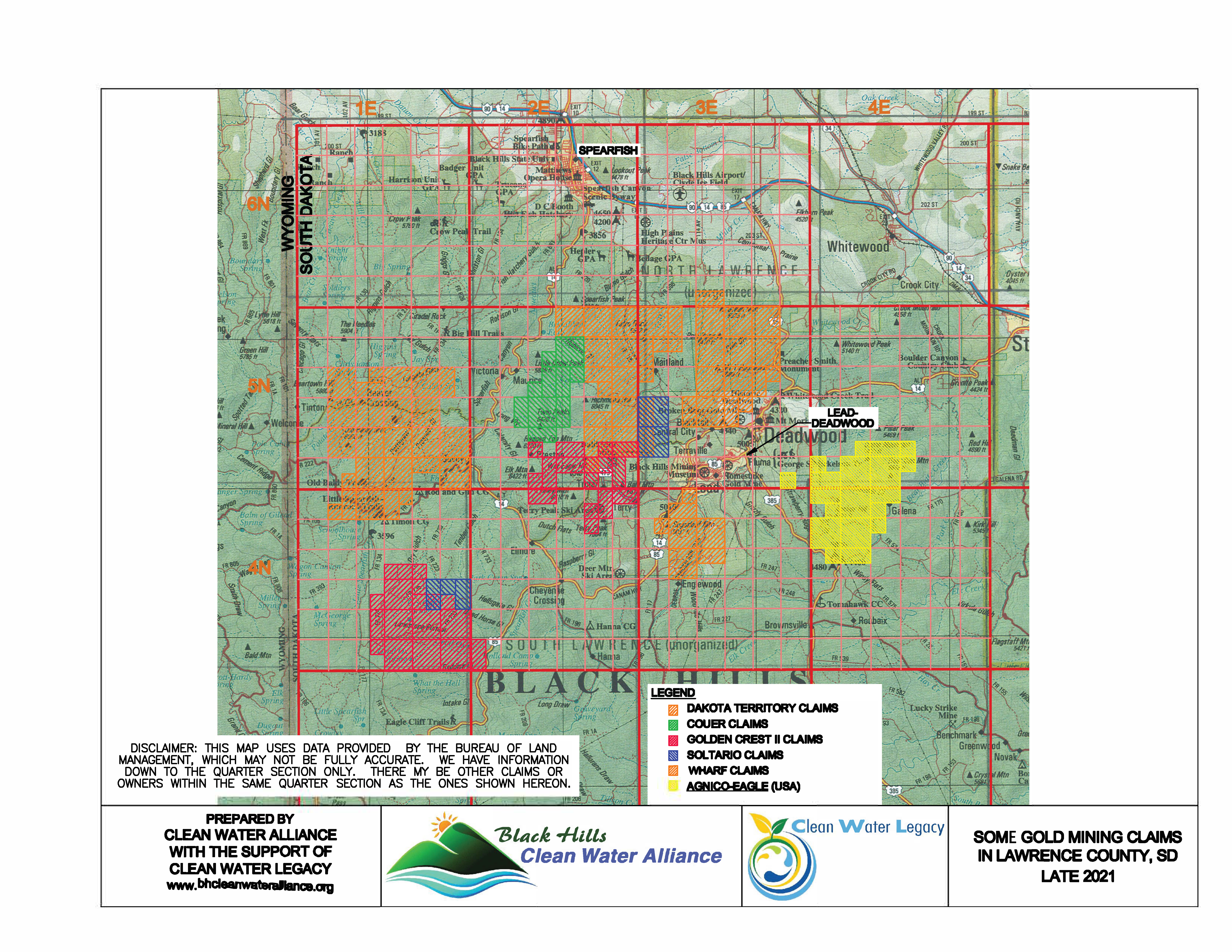
The second map, titled “Some Gold Mining Claims in Lawrence County” shows the mining claims held by six gold companies in the northern Black Hills as of, variously, December 2021 or January 2022. You can see that not all gold claims are on this map. This map does not show all of the existing Wharf Mine or the closed Homestake Mine, which occupy the area north of Terry Peak and north of Lead, respectively. It is likely that much of these areas has been patented, or turned into private property, so they would no longer be under claims. Note that Coeur Mining owns the Wharf Mine, but some claims are in each entity’s name.
Here are some of the highlights of what these maps show:
- About 148,000 acres in the Black Hills are under either active or filed mining claims, and the active claims cover a total of about 230 square miles. Most of them are held by gold companies.
- On the all claims map, the activity along the Wyoming-South Dakota border in Custer and Fall River Counties is a uranium project, which has expanded somewhat in recent years to over 12,000 acres. This project started applying for permits to mine about 12 years ago, but is still unable to move forward.
- Also on the all claims map, the activity in the far northwest corner of the left map is a potential rare earths mine in the Bear Lodge Mountains. This project has come back to life in recent months, after being on hold for several years.
- A high proportion of the Rapid Creek watershed in Pennington County is now claimed. This claims area is substantially larger than it was a few years ago, and most claims belong to F3 Gold and Mineral Mountain Resources. The former is trying to drill in the Jenny Gulch area just upstream from Pactola Reservoir, where a gold mine would be catastrophic due to the threats to Rapid City’s water. The latter has been drilling since 2018 and is located near Pe’ Sla and Rochford. (Note: the smaller maps on the right of the all claims map minimize this activity. It is easier to see what is going on using the left map.)
- Spearfish Canyon is surrounded. Companies in addition to the 6 gold companies we mapped in the northern Black Hills are active in that area. On the all claims map, you can see a narrow passageway between claims at the Canyon and how the scenic Canyon, its water, and its residents are threatened.
- Of the individual gold companies that we mapped in the northern Black Hills, Dakota Territory Resources (soon to be Dakota Gold Corp.) has the most claims – over 35,000 acres. We know this company has additional claims that are not yet in the database that was the source of this map, in particular in the Maitland area north of Central City. This company is linked to Barrick Gold, the second largest gold company in the world.
- F3 Gold has been busy expanding its mining claims in recent years. Its central Black Hills claims now stretch from south of Sheridan Lake and well up into Lawrence County, and across a broad area of bighorn sheep habitat. It has claims immediately west of Custer and to the north into Pennington County and has also applied to drill on some of this area (the Newark Project).
- The threats to water are very real from these projects. But there are other considerations, as well. For example, those who enjoy recreation of any type in the Black Hills face the prospect of losing large recreational areas to mining, if the gold rush is not contained. Recreationists and recreation businesses of all kinds, including the tourism industry, should work together to oppose mining in the Black Hills.
Each claim a mining company has on federal land gives that company the right to mine without paying federal royalties. This is due to the 1872 General Mining Law. Surface landowners do not have the right to stop mining of sub-surface federal minerals under this law, which was tailored to the needs of a newly industrializing nation. Mining companies operating under this law have uprooted entire towns. Attempts to update the law to require federal royalties or to give surface owners a say in the mining process have failed so far.
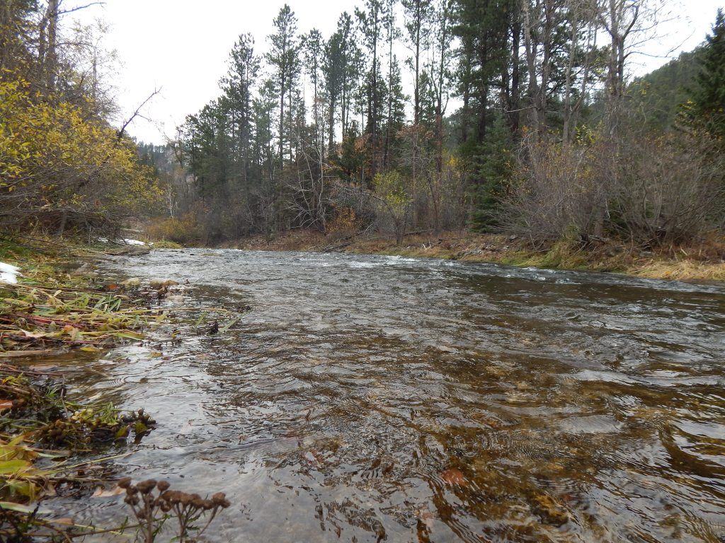
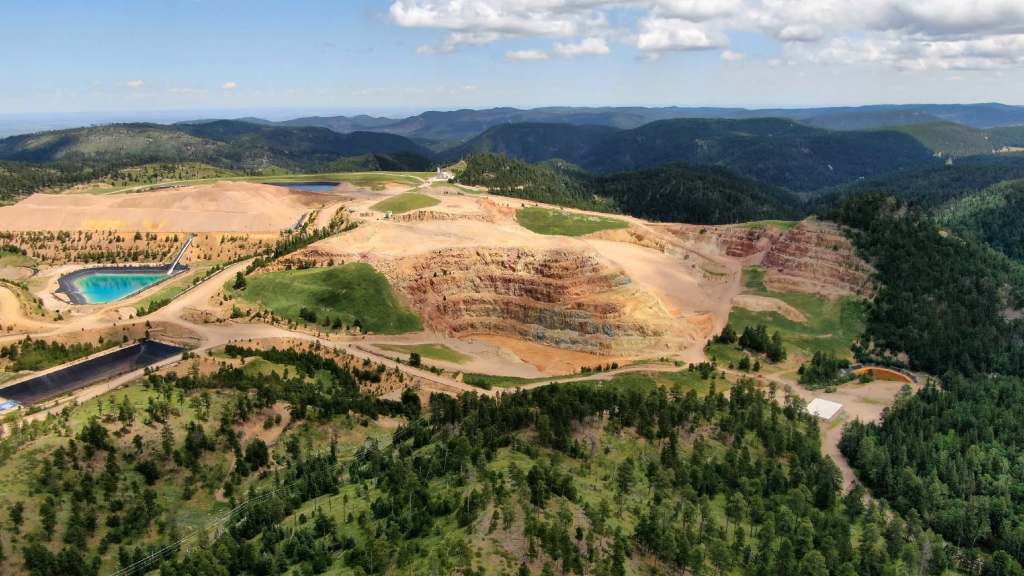
Gold mining and processing are destructive and dirty businesses and have led to two Superfund sites in the Black Hills – one including 18 miles of Whitewood Creek downstream from the Homestake Mine and one at the Gilt Edge Mine south of Deadwood. Cyanide and other chemicals are used, and arsenic is a common byproduct. Accidents do happen, like at the Gold King Mine in Colorado in 2015, which had impacts 150 miles downstream. Studies show the contamination from gold mining in the northern Black Hills reaches to the Missouri River – about 175 miles away.
The information used to make these maps was collected in December 2021 and January 2022. The map titled “Current Bureau of Land Management Mineral and Land Records System Active Mining Claims” includes all active claims in the Black Hills at that time. Note that companies have staked additional claims in recent months that do not show up on these maps. This is because the Bureau of Land Management, which administers the mining claims process, is about six months behind in registering claims. So these maps do not show all claim activity at this time. We will continue to update the maps periodically.
Our thanks to Mato Ohitika Analytics LLC and Frank DiCesare for their mapping skills and to the Windrose Fund and Clean Water Legacy for their financial support of this project.
